From Petersburg to Amelia County, there is no direct route. It’s a good example of a classic dilemma in the South when giving directions: “You can’t get there from here.” Anyone not from the South can’t quite understand the logic, but it’s true, nonetheless. You have to go somewhere else to get to where you are going.
Day Two of the trip: We puzzled over the map, Pop-eye style, and saw that we were going to have to sort out a path while we were on the way. Google was no help; it sent us somewhere else to get to where we wanted to go, in true Southern fashion.
It wasn’t so much that we wanted to see Amelia Courthouse, but it seemed that we could reconnoiter when we got there. Our true mission was to find the plantation The Oaks, even though the house had been moved from there to Richmond almost one hundred years ago. And perhaps some lunch could be found.
We crossed over the Amelia County line. Not far into Amelia County, we passed by an old building with an odd collection of items and a man in a recliner on the front porch. He called out to us as we passed by, and Sugar said to turn around and go back to see if the man knew where Mattoax was.
Turns out, the man didn’t know where it was, so perhaps it didn’t exist any more. If anyone knew where Mattoax was, it should have been this man, but after further conversation, he had only been out of the state of Virginia a few times in his life. He asked where we were from, and when we said South Carolina, he looked wistful and said he had always wanted to go to South Carolina. His name was Jimmy Olgers, and he was the high mayor and proprietor of Olgers Museum. He said that this great-grandfather was in the battle at Saylor’s Creek. Sugar didn’t chime in and say that his great-grandfather had been there, too. He let the man have his moment and wax rhapsodic about the good old days.
He invited us into his museum, but declined to accompany us because of health reasons. The museum was actually the house he grew up in; he said that he was born in the back room. There were things there that should have been kept in a climate-controlled vault, like books and newspapers. There were hand-lettered memorials to his family members where Jimmy had listed names and relationships and dates of birth and death. It was the most unusual collection of items I had ever seen, like kewpie dolls, advertising signs, utensils, tools, and bric-a-brac.
There was a collection urn at the entrance for donations for the upkeep of the museum. Sugar dropped in a donation. After we finished the tour, we stopped back at the front porch, and Mr. Jimmy talked some more.
He eyeballed Sugar, and said, “How old are you?”
Sugar: How old do you think I am?
Mr. Jimmy: Take off your hat!
(Sugar removed his ball cap.)
Mr. Jimmy: Seventy-one!
(One of the reasons I call him Sugar is because his hair is white like sugar. There’s other reasons, too.)
Sugar: (exhales loudly)
Sugar: That’s right. (Not true.)
Mr. Jimmy: (Delightedly) I knew it! I’m always right!
Mr. Jimmy: Why, that woman is twenty-five years younger than you!
YoursTruly: Heh! (Sugar clapped his ball cap back on his head.)
Mr. Jimmy: She’s your *second* wife, isn’t she?
Sugar: (Nodding his head.) That’s right. (He considered retrieving his donation.)
We said good-bye to Mr. Jimmy, who started talking about a Civil War battle that happened across the road at his ancestor’s house, and we headed in a westerly direction.
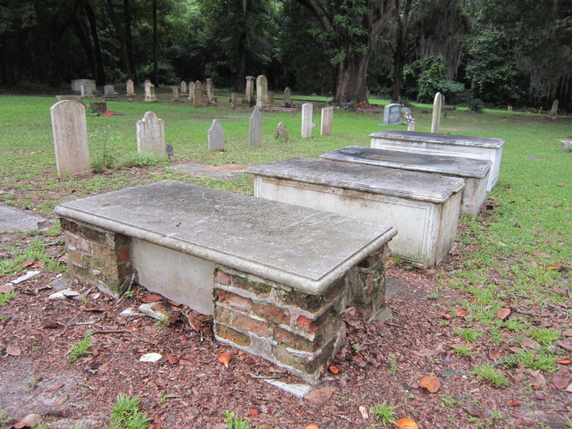
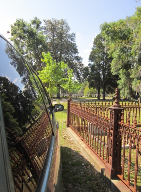
Somehow, we made it to Amelia Courthouse, the county seat where the historical society was located. It was closed – the historical society, not the county seat – because it was Memorial Day, duh us, but also due to construction.

Well, now, that’s awkward. The only day in our life to be in Amelia County for historical research, and we are going to have to rely on our notes, our memories, and Sugar’s great-grandfather’s Book of Reminiscences, and then we discover that he has forgotten the book.
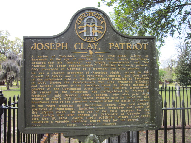
At this point, it hardly mattered, because there is a historical marker for William Branch Giles, yet another one of Sugar’s ancestors.
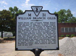
WILLIAM BRANCH GILES
Noted lawyer and statesman William Branch
Giles was born12 Aug. 1762 in Amelia County
and educated at Hampden-Sydney College,
Princeton, and the College of William and
Mary. Giles served Virginia in the United
States House of Representatives (1790-1798
and 1801-1803) and in the U.S. Senate (1804-
1815), where he was a chief Republican ally
of Thomas Jefferson during the Republican
and Federalist party debates of that era.
Giles was elected governor by the General
Assembly in 1827 and served until 1830. He
participated in the state constitutional conven-
tion of 1829-1830. Giles died 4 Dec. 1830
in Amelia County and is buried near the
Wigwam, his house, which stands to the north-
west on Rte. 637.
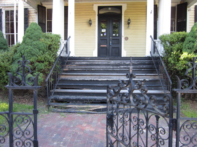
Hmmm, Route 637. It’s not on the map. We circled around the downtown area, which was quite small and closed up tight as a drum. Sugar spotted a man outside what appeared to be a bed-and-breakfast, and he commanded the van to a halt.
The man said that it used to be a bed-and-breakfast, but when the economy failed, they started taking in long-term renters instead. He didn’t know where Mattoax or the Wigwam or Route 637 were. and he produced a little map of the local area, which also did not have Route 637 on it. There were some numbers that were close, and we wondered if the route number on the historical marker was incorrect.
He gave us general directions heading east, and after our goodbyes, we headed over to a four-lane divided highway. We were looking for Chula, and thought that we had missed our turn, with that typical nervousness that lost people with poor directions have. So we stopped at a sandwich shop, one of the few places that was open.
The sandwich shop has a good crowd of local folks, but we didn’t ask anyone, not even the police officers, where Mattoax or Route 637 might be. We’d already struck out with Mr. Jimmy and the B and B guy, so it was beginning to look doubtful that local folks could help.
So we looked at the map of Richmond and the surrounding area ONE MORE TIME, and headed east again on the four-lane, Highway 360, also known as Patrick Henry Highway.
Highway 604, Chula Road, turned left off of Patrick Henry Highway, so we did, too. A car behind us rode our bumper as we crept along looking for Mattoax Lane on the right. This continued forever, or perhaps about 15 minutes, and as the car raced past us downhill, we saw it on the right. Mattoax Lane.
There’s nothing left of Mattoax. No train station, no post office, just a little lane that winds along to the Appomattox. We followed the lane along to almost the end, a green, leafy amble past fields and trees and not much else.
The lane ended in a gateway for a restricted community. No trespassing. We were so close to finding where The Oaks was. No trespassing. We did not feel like going to jail on this day, so we turned around and headed back out Mattoax Lane.
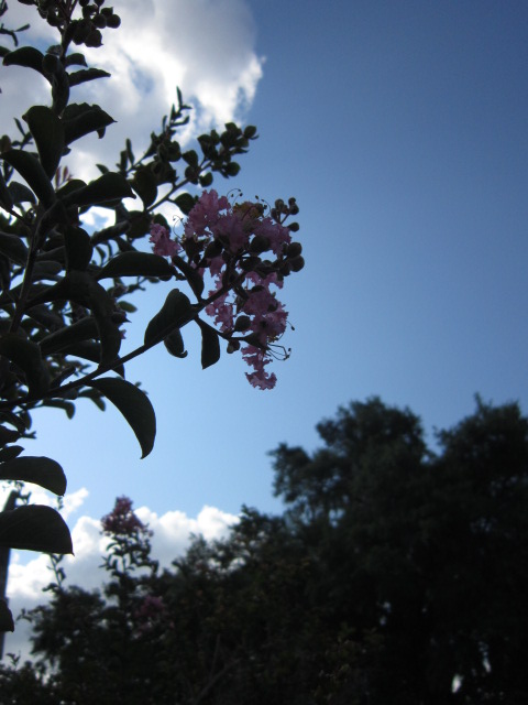
We drove further along Chula Road where it stayed Highway 604 but became Genito Road. We knew that it crossed the Appomattox at some point, so if we only had a boat, we could float down the Appomattox past the old location of The Oaks.
A photo of the Appomattox will have to do for now. The bridge was quite high and cars were whizzing also. This was a totally unsafe maneuver on my part, but I had to get the shot.

Our next plan was to find The Wigwam, even though we were feeling discouraged at not being able to get to The Oaks property.
We headed back toward Chula, and I pulled over to get a shot of the Mattoax Lane sign.


Well, this wasn’t helping us find Route 637, so Sugar proposed another turn-around to head north of Chula to find The Wigwam. We wound around a good bit, grateful for a large tank of gas, and Sugar pointed to another lane that headed south, which was not the direction we should be going in, but we are on vacation, and in no hurry, so why not?
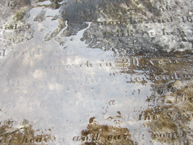
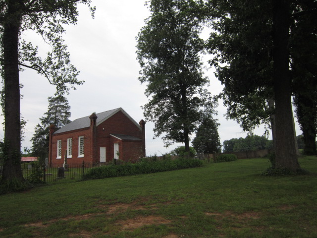
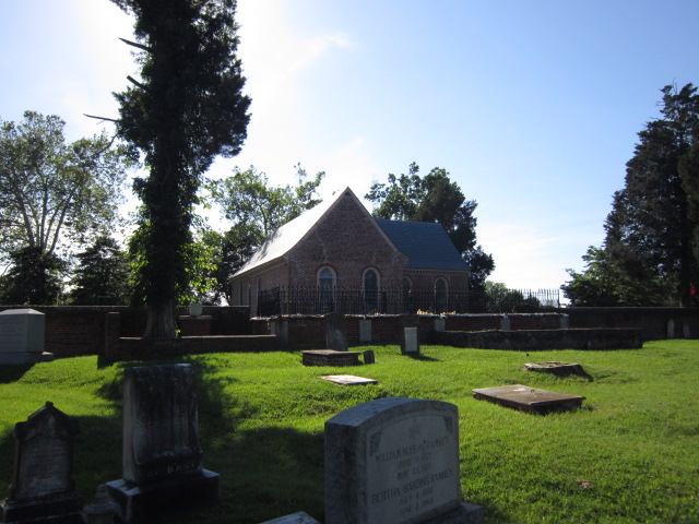
A turn in the road revealed a brick church, which looked exactly like the church that Sugar’s cousin found perhaps twenty-five years ago as the location of where William Starr Basinger and Margaret Roane Garnett got married.


This was exactly the church where they were married, except it wasn’t. Sugar’s cousin found the wrong church. But this is exactly the church where Sugar’s cousin had his photo taken on the steps.
You might ask why this looks like the back of the church is facing the road. You are very clever, and you already know the answer. The road was not here when the church was built. There was another road in front of the church which was further into the valley, and apparently was impassable from time-to-time, so a new road.

The true front.


Hickory nuts were everywhere, and we saw chipmunks scampering about.

We headed on in search of The Wigwam. Did we find it? Stay tuned.