Posts Tagged ‘SC’

Agnes Mann, Hotel Keeper of Beaufort, South Carolina, 1880

June 16, 2014

(This is the eighth part of a series.  If you would like to start at the first part, click here.)

Sometimes when I’m talking to Sugar about some family research, and I mention that I’ve branched out, and I start chattering on about someone he doesn’t know, he’ll say that’s pretty far afield.

Or like this weekend at the Lawton family reunion when we met a man who said that he wasn’t related to anyone there, and that he was a historian and a preservationist, and that he had read my blog.  “Many times.”  So I’m not sure what to say, because clearly this could go badly very quickly, and I recover and ask have you read Basinger’s Civil War letters?  And what about the Bateson family that has been lost and found in Savannah?  What about those?  Huh? Huh?  (Sweating here and not just because it’s 90 degrees.)

Sugar cleared his throat and says that that’s getting a little far afield.

I actually don’t stomp on his foot here.

Sometimes I think that people want to talk about what I want to talk about.  If he’s reading the blog, what’s he reading?  I’m now guessing it’s about Lawtons.

Sigh.

*****

Agnes Mann was a hotel keeper in 1880 in Beaufort, South Carolina.  You can left-click on this 1880 census to enlarge the image.

MannAgnesHotelKeeper

She was the mother of Martha, and Martha married a Thomas Bateson.  Both Martha and Thomas were deceased by 1880.  I’m still working on more information about where they met and married, most likely in Christ Church Episcopal in Savannah, Georgia, but those records are no longer at Christ Church, so we’ll see.  We’ll see.

If you don’t want to read about Manns and Batesons, you’ve probably already stopped reading.  Now that the crowd has thinned, we can just talk amongst ourselves.

Sugar hummed and hawed over the “hotel keeper” position, and wondered what hotel it could have been.  In Savannah, there were many boarding houses, according the the census records I’ve looked at, but we couldn’t locate any in Beaufort.  Perhaps this was really a hotel.  Perhaps it was the Sea Island Inn.

I googled it, and eureka!  There’s the Sea Island Inn!  Oh, hello, it’s a Best Western on Bay Street.

Well, that’s no good, but what if the Best Western Sea Island Inn was built on the spot of the original Sea Island Inn?  What if the Sea Island Inn was torn down before the preservation movement?

I looked at the Beaufort County Library’s Lowcountry Digital Library’s online collections, and the first image that came up in the Lucille Hasell Culp Collection is the Sea Island Inn, taken in the 1950s.   (You have to click on the link to see the photo.)

In the meantime, Sugar went to findagrave.com and found the memorial for Dr. George Mosse Stoney.  There’s a photo of him on the memorial and also a photo of his house.

GeorgeMosseStoney House

Built by Dr. Stoney, sold to Nathaniel B Heyward,

rented to John Allan Stuart; Headquarters for

General Saxton during Federal Occupation.

(Notice guard billet in front of fence).

Added by: sticksandstones
10/19/2012

Have you ever been to the Library of Congress?  Well, you should go to their online site at http://www.loc.gov.  They have *MAPS*.

Here’s a link to the map of the city of Beaufort, South Carolina, made during the war. Click here.  The map is below, too.  If you go to the website, you’ll get more information.

BeaufortSC CivilWar (02)

Do you see at the very bottom near the center there is a building, not in red?  Zoom in on that.  It’s Saxton’s headquarters.  And across the street in the bay is a bath house?  It’s connected to the mainland by a boardwalk. Now go back and look at the photo of Dr. George Mosse Stoney’s house. Someone took the photo across the street from the house, and they are standing on a boardwalk.

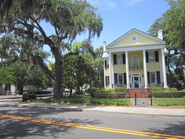
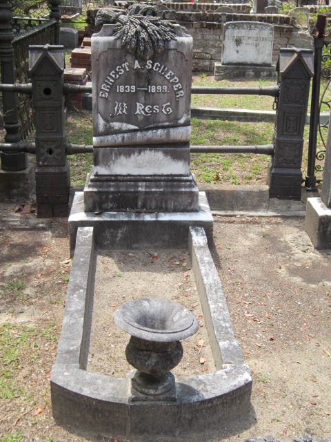
A modern day map shows the Best Western Sea Island Inn at the same location at Saxton’s headquarters.  The Scheper house is further west on Bay, although most of the town’s houses are not shown on the map unless they are being used for military purposes.

Is this too far afield?  Let’s consider that Dr. George Mosse Stoney’s grandfather is Dr. George Mosse of Ireland, South Carolina, and Savannah. Isn’t that name familiar – George Mosse?

Oh, that’s right, he’s Sugar’s ancestor…

And everything is a circle.


Bateson, Mann, & Scheper: Or, On to Beaufort!

June 12, 2014

(This is the seventh part of a series.  If you would like to start at the first part, click here.)

I found a death certificate for Martha Mann Bateson’s sister.  She died in Hendersonville, North Carolina, a small town where my mother’s 1st cousin’s husband was once mayor.

Another surname popped up that we hadn’t seen before in relation to this family. Scheper, for another of Martha Mann Bateson’s sisters. Which doesn’t explain why they were in Hendersonville, North Carolina.

When I told Sugar, he said, “That’s a Beaufort name.”  And he would know this stuff.  Although I’d never heard of it, I’m not from around here.  So this means a trip to Beaufort.  Squeee!  It’s an easy day trip.

He has a book (of course) about historic Beaufort, and there is mention of the E. A. Scheper house and the address.  It was so easy to find.  Why can’t everything be so easy.

*****

A little back story before we go into Beaufort:  Sugar’s grandfather and his 2nd wife built a house on the banks of Battery Creek.  He died before Sugar was born, but his 2nd wife continued to live there, and Sugar knew her.

He was ready to take a trip down memory lane, and to see the house again. That’s how it is sometimes.  We’re not sure if we’re ready to relive old memories, so we just don’t.  Sometimes it’s time to do it.

Here’s the house where Sugar, his brother, and his parents would visit his step-grandmother…

IMG_6588

This is the street-side, which is actually the back of the house.  The front opens up to Battery Creek, which is a deep water channel, and you can put in a boat there.  Some additions and improvements were made over the years, but basically the house still appears the same in his memory.

He wanted to walk right on to the creek, right through the yard, which I thought was a bad idea, what with trespassing and all.  Sometimes he’s bold, to be so shy.

Instead, we drove further around the lane that ran parallel to the creek.  We saw a lot for sale, so we stopped there and walked through the lot to the cove.

There’s a large live oak near the center of this photo. Do you see Sugar to the left of it? Now you get a better idea of exactly how large this tree is.

IMG_6590

IMG_6591

A few branches, strategically removed, would expose a wonderful view.  I’m guessing, since I can’t actually see the view.

IMG_6592

IMG_6593

Look through the tree branches, and you’ll see someone’s dock in the distance.

Same big tree in the first photo of this lot.  Sugar has just walked by, and he’s behind the tree, just wandering about.

IMG_6594

Onward to downtown Beaufort.  We’re looking for the E. A. Scheper house, which is clearly identified in Sugar’s book, and then we hope to find where Agnes Mann lived.  Agnes was the mother of Thomas Bateson’s wife Martha. Agnes had another daughter, Louisa, who married E. A. Scheper.

IMG_6595

We pulled off on the side of the road.  The bay is to our right, so, yes, we’re on Bay Street.  There was another car pulled over, and a man with a very tall stepladder was standing on the ladder taking photos of the homes on Bay.  I’ve never considered the considerable advantage that height would add to the improvement of my photos, except those times when I stood on the car.

IMG_6596

IMG_6597

IMG_6598

Proof that the Scheper house is on the corner.

IMG_6599

We know on one census that Agnes Mann lived at 117 Craven Street. We head over to Craven, bold with the thought that we will find the house.

Did you know that Beaufort was built on a point of land?  We ran out of street.  Craven is a shortish street, and we started from the most inland end, about an 800 block, and it ended at the river at about a 400 block.  So let’s guess that the street numbers have changed.  So that must mean that the house that the Manns lived in was still standing, for that side of the street, that odd-numbered side, had many houses on it.

Out of frustration, I took a photo out the van driver’s side window of a random house, as if to prove that we were there.  We’re looking for you, Agnes!  Where the heck are you?

IMG_6600

Drat. It’s time to head on over to the St. Helena Episcopal Church and Cemetery.

Agne’s husband Daniel is buried there, according to findagrave.com, so surely she is, too.  Although I suspect that she has no headstone, or I would have found a memorial on findagrave.  Surely that. We park in a lot across from the church.

IMG_6601

IMG_6602

IMG_6603

IMG_6604

IMG_6605

IMG_6606

He went right, I went left, and dadburnit.  Here’s a bunch of Lawtons, gumming up the works.  What are these Lawtons doing here?  Who are they? (Sugar found out later that this Lawton line descends from William Lawton’s 2nd wife.  All the Lawtons that we know descend from William Lawton’s 3rd wife.  Bonus line!)

IMG_6608

IMG_6609

IMG_6610

IMG_6611

IMG_6612

IMG_6613

IMG_6614

IMG_6615

IMG_6616

IMG_6617

IMG_6618

IMG_6619

IMG_6620

IMG_6621

IMG_6622

IMG_6623

IMG_6624

IMG_6625


Here’s Louisa’s husband, E. A. Scheper.

IMG_6626

IMG_6627

  Squeee!  Here’s Louisa.

IMG_6628

IMG_6629

IMG_6630

IMG_6631

IMG_6632

IMG_6633

IMG_6634

IMG_6635

IMG_6636

IMG_6637

IMG_6638

IMG_6639

IMG_6640

IMG_6641

IMG_6642

IMG_6643

IMG_6644

IMG_6645

IMG_6646

IMG_6647

IMG_6648

IMG_6649

Did we find Agnes Mann? Nope.  But she’s probably here.  We’ll have to find someone that knows something.  Historical society, perhaps?

The Breeler Field Cemetery

December 23, 2013

After taking a photograph of every.single.marker in Solomons Cemetery, we got back in the van and drove further along the lane to find Breeler Field.

IMG_5494

Breeler Field is big, so only a few photos were taken for Reader Maureen, who is researching the Beckett family.

IMG_5495

IMG_5496

IMG_5497

IMG_5498

IMG_5499

IMG_5500

IMG_5501

IMG_5502

IMG_5503

IMG_5504

IMG_5505

IMG_5506

IMG_5507

IMG_5508

IMG_5509

IMG_5510

IMG_5511

IMG_5512

IMG_5513

IMG_5514

IMG_5515

IMG_5516

IMG_5517

IMG_5518

IMG_5519

IMG_5520

IMG_5521

IMG_5522

And because Mama Florrie’s father was a Gant, I took a photo of the only Gant I saw, not knowing if/how this Gant fits into Mama Florrie’s family.

That’s Breeler Field. Easy to find, and full of stories.

In Search Of Transpine

November 23, 2013

Sugar’s ancestor was Colonel Alexander James Lawton.  He’s found several references to where the Colonel is referred to as “Alex”, like in the papers of Benjamin Spicer Stafford.  Every time we’ve talked about him, we’ve always called him Alexander James.  Like at the family reunions, the organizers divide the attendants up into groups depending what child of Joseph and Sarah Robert Lawton they descend from.  There’s only one other family that descends from Alexander James, and they descend through his youngest child, Edward Payson Lawton.  In the papers of Benjamin Spicer Stafford, he refers to this person as “Ned”.

I love this so much, this finding of these little facts that personalize these long-deceased people.  “Alex”.  “Ned”.  I. Love. This.

There are other references that we’ve found that refer to Transpine Plantation  being part of the larger Mulberry Grove Plantation.  I don’t know why one plantation would be part of another one.

Which brings us back to the enormous oak that we saw.  Live oaks mean something here.  Many times they define an allee, or lane, to a house, like a driveway.  A lone oak?  I don’t know specifically.  But it means that someone was there.  It brings a humanness to the spot.  We’ve seen one other oak that was bigger, and that’s the Angel Oak.

In some of his reference materials, Sugar saw where Alex Lawton had a small house, basically cabin sized, built for his mother Sarah Robert Lawton to live in during her later years, and it was built at Transpine.  The enormous oak we saw was next to a little house, and he wondered if that would be the location of Sarah’s house.

We wiggled all week in anticipation of going back to see the tree up close and to measure the house.

*****

We drove past, and saw yet something else that we had missed in all our previous passes.

IMG_5274


It’s less than 20 feet from the dirt lane.  What is it?

IMG_5263

We wore our rubber boots because we have no idea what we might step into.


IMG_5264

This building is all cattywampus. I told him not to go in there because it was going to fall down around his ears. I wouldn’t go in at the same time in case it collapsed. Somebody would need to be able to call 911.


IMG_5265

To the right of the door.


IMG_5266

To the left of the door. Perhaps this was an old store.

IMG_5267

Okay…
I’m leaning in the door at approximately the same angle as the left wall. This place is scaring the bejesus out of me.


IMG_5268

The left side of the building.


IMG_5269

Part of the support system holding up the front porch.

We walked along the left side of the building, and Sugar said, “Don’t step on that skull.”  I said “huh”, and looked down and saw that I was indeed stepping on a skull.  Just a skull, no skeleton.


IMG_5270

IMG_5271

The back wall has completely fallen away from the building. See the sunlight coming THROUGH the building?
My apologies for being to antsy to allow the camera to focus clearly before I made this shot.

IMG_5272

I manned up, and skittered inside the building to get a detail of the wall support.


IMG_5273

And when I turned, I saw a chimney suspended in the air.

I skittered back out, and we decide to get back in the van to head toward the enormous live oak.

But first.  The morning sun slants through the trees.  We are facing south, and there’s a half-allee of live oaks on our right.

IMG_5260

IMG_5261

IMG_5262


Further along this lane is the enormous live oak.  I was still jittery about the ambiance at the old building, and I didn’t have my wits about me to remember to take a photo of the tree with a real-life frame-of-reference, like a person.

IMG_5275

But see that tiny building to the left of the tree? That’s about 22′ wide by 34′ long.
Are you getting a sense of how big this tree is?


IMG_5276

IMG_5277

IMG_5278

This long horizontal branch has broken away from the tree, although it is still attached.

We turn onto the field lane, which is between the house and the field, and stop to have a bite of early lunch.


IMG_5279

That mass of greenery is the house.


IMG_5280

This is a zoom shot of the previous view. See the walls of the house under all the greenery?


IMG_5281

IMG_5282

Sugar brought his machete because of all the vines. He’s chopping and whacking a path for us.


IMG_5283

IMG_5284

Dear God, that’s a widow-maker hanging over his head. I was as jumpy as a long-tailed cat in a room full of rocking chairs, but he wasn’t worried.


IMG_5285

IMG_5286

IMG_5287

IMG_5288

IMG_5289

IMG_5290

IMG_5291

IMG_5292

IMG_5293

IMG_5294

IMG_5295

IMG_5296

IMG_5297

IMG_5298

The house is not the right dimensions to be Sarah’s house at Transpine, but perhaps it was here once.  Regardless, Sugar named the live oak “TransOak”.

Then onward past what we believe to be the original location of the house at Mulberry Grove which was burned by Sherman.  There’s a lane which is marked No Trespassing, but the road map shows that it is a public road.

Yes, we did drive along it.  And took photos out the driver’s side window.  Some are zoomy, some are not.


IMG_5299

IMG_5300

IMG_5301

IMG_5302

IMG_5303

IMG_5304

IMG_5305

The gate to the driveway to the house.

IMG_5306

IMG_5307

Further along the lane, we come to more fields.


IMG_5308

IMG_5309

IMG_5310

Peanuts!  My father used to plant peanuts.

Sugar agreed to go again to the Lawton Cemetery so I could take some photos of headstones to confirm that this was indeed the Lawton Cemetery that Mama Florrie said it was.

And that’s another blog post.  (Spoiler:  she was right.)


Frieda Rauers Cunningham Swain, 1892-1974

October 26, 2013

All the conversations about Lawtons, and Cunninghams, and Rauers, caused Sugar to dredge up a memory.

There was a woman in his hometown who wasn’t seen very much.  Every small town, and certainly big ones, too, have people who keep to themselves.  So much so, that they became known as recluses.  (If I didn’t have to leave my spot on the couch, I’d be good with that.  I’m a recluse in training.)

Some recluses have become that way because of personal tragedy, or embarrassment, or painful shyness.  Sugar remembers that sometimes his mother, who was reclusive, would mention that she “saw Frieda today”.

Sugar and his mother didn’t talk very much, like lots of parents and children.  I don’t remember having very many real conversations with my parents.  Everything was understood and already said.

To me, for him to remember that his mother mentioned seeing Frieda was of some importance, some significance, in her appearing in public.  We wondered if we could find out more about her.  He found a bit about her husband in one of his books, and I went in search of her on the internet.

I found her on findagrave.    This meant we had to go to Bluffton.

*****

Sugar grew up in Bluffton.  Yet he had never been to the Bluffton Cemetery, because his people were most recently from Savannah.  We had no idea where to start, so we parked along the drive into the cemetery, and wandered about.  I was happy that I had my rubber boots in the car, what with all the rain.

And somehow, Sugar wandered right up to her gravestone.  She shared it with her husband, William Moseley Swain.

IMG_4551

IMG_4552

IMG_4553


IMG_4554

And, as is my way, I circled around the plot taking photos.

IMG_4555

IMG_4556

IMG_4557

It’s an old graveyard.  There are many nice trees and plantings.


IMG_4564

IMG_4565

Sugar saw some folks he knew.

IMG_4566

Imogene Fripp Lowden


IMG_4567

Enid Fripp Duncan


IMG_4568

Kirk was a childhood friend of Sugar’s.


IMG_4569

IMG_4570

Harry Oliver “Ollie” Lowden, Jr.


Then I took a photo of this small headstone, just because.


IMG_4574

And on the opposite side….

IMG_4571

Gone to be an angel

I don’t know who Jane Hope is, but her headstone was all alone, so let’s remember her here.

IMG_4575

IMG_4578

The Van Duyn family had a bulb farm. Sugar remembers it.


IMG_4581

Most of these plots are not fenced off.  The next one was, although overgrown, and I had to keep pushing branches out of the way in order to get the next photos.

IMG_4582

IMG_4584

The Martin family is an old name in this area.  And there’s Ole Yeller, faithfully waiting at yet another graveyard.

IMG_4589

IMG_4588

IMG_4586

So it was a good outing.  We found what we were after, Sugar found some old friends, I found some interesting markers, and no one was arrested for trespassing.

Patience Taylor, Born 1868, Died December 11, 1917

October 2, 2013

A few posts ago, while looking for Colonel Lawton Cemetery, Sugar and I were at Bostick Cemetery in the area outside the fence.

And after we found Colonel Lawton Cemetery, about a week ago, I had the bright idea that I would start a new blog.  You see, I started browsing through the South Carolina Death Records on www.ancestry.com and found many, MANY death certificates for people that had no headstones in Colonel Lawton Cemetery.

That’s right, *no* markers of any kind.  Nothing physical to show any visitors that anyone was there except the depressions on the ground.

I decided to start a new blog just using the death certificates and/or the photos of the headstones.

Reader Sharon contributed the name “Certifiable Presence“.  LOVE the name.

Today I was scrolling through 1917 and found a death certificate for Patience Taylor in Bostick Cemetery, which rang a bell.  It turns out that I took a photo of her headstone, but didn’t transcribe it.

I have learned that if you don’t put the words out there, search engines cannot find you.  So in remembrance of Patience Taylor, here is her marker and death certificate.

Patience Taylor, wife of Stephen Taylor

Patience Taylor, wife of Stephen Taylor

Notice that the death date and her age on the headstone and the death date and her age on the death certificate do not match.

SouthCarolinaDeathRecords1821-1955 (63)

“Faithful to her trust,

Even unto Death”

The Citizen’s Free Library

September 26, 2013

When Sugar bought the grooming-and-boarding business two years ago, he signed a three-year lease on the building.  We considered that now that the lease is almost up, perhaps we should look at other properties, even though we don’t think that there will be anything available.

We looked at buildings that were for rent or sale in our little town.  We didn’t actually tour any, we just looked at the outside and considered if it was large enough and what renovations it would need.

One of the buildings was the old Coca-Cola building.

IMG_4950

It was a patchwork-looking affairs, and had several additions to it.  It probably wouldn’t work, but we drove around the building anyway….

…and found the Citizen’s Free Library.

IMG_4939

IMG_4940

And because Sugar is a book collector, of sorts, we had to get out and take a look.

IMG_4941

IMG_4942

I didn’t even want to touch them.  They were dusty, and warped, and some were mildewed, and they smelled bad.

IMG_4943

IMG_4944

IMG_4945

I said, “Oh, my gosh, this is just ridiculous.  Why are you looking at these?  These are just disgusting, and don’t even think of taking any of these books, and ohIhavetohavethisone.  It’s Sam Levinson!”

IMG_4946

IMG_4947

IMG_4948

There were embroidery hoops, and old stuffed animals, and Yarn!

IMG_4949

Sam Levinson wrote the first adult book I ever read.  I was probably in the fourth grade, and I was standing in front of the children’s section in the church library, trying to decide which book I was going to read – again – and the librarian said, “Let me show you this one.”  And she went to the next bookshelf (it was a very small library that had maybe four bookcases), and she pulled off Sam Levenson’s “Everything But Money”.  I protested that it would be too hard for me, and she said that it wouldn’t.  I was worried that I was going to get in trouble for reading a too-hard book, but I was taught to obey figures of authority, so I was stuck.

It was the best book ever.

And now, thanks to the Citizen’s Free Library, I have my very own Sam Levenson book, “In One Era and Out the Other”.

IMG_4992

Thanks, Citizen’s Free Library!  No late fees!

Where Is Colonel Lawton Cemetery? (Part 3)

September 23, 2013

I stand corrected.

There is a marvelous book of cemeteries and the burial inscriptions.  I went to the local library today to take a look.

What I’m calling Colonel Lawton Cemetery is both right and wrong.  According to the cemetery book, Colonel Lawton Cemetery is the one on the left side.  That’s the overgrown one with some home-made headstones and unmarked depressions in the ground.  Murphy Cemetery is on the right.  It’s the well-kept, well-marked one.

But the death certificate for Wesley Eugene Murphy says that he is buried in Colonel Lawton Cemetery.  His headstone, linked to my finding his death certificate, was my first physical clue that confirmed that this was indeed the right cemetery.

It appears that over time the Murphy family was buried on one side, and the name gradually became known as Murphy Cemetery.  At least that’s the way it looks to me.

The inscriptions that the book gives for Colonel Lawton Cemetery are pretty much what we gathered yesterday.  The book indicates that there are many unmarked graves.

Reader Sharon says to call the new blog “Passing Through” or “Certifiable Presence”.

Now we need a subtitle for the heading.  Like “The documented burials in Colonel Lawton Cemetery”.  You get the idea.

Where Is Lawton Cemetery? In Which I Ask Miz Florrie

September 20, 2013

One day I’m at the Laundromat, and while I’m waiting for the clothes to dry, I call Mama Florrie to say hello.  She said, “When are you coming?”

When your mama calls, you should go.  I had the rest of the day off, and I stuttered in surprise that I could be there in two hours.

*****
If you use www.ancestry.com to search for South Carolina Death Records, like I do, you can find some old certificates that show the deceased is buried in Lawton Cemetery or Col. Lawton’s Cemetery or Lawton Pl. Cemetery.

Where is that, exactly?  There’s no Lawton Cemetery on the map.  Don’t confuse it with Lawtonville Cemetery, which I’ve already written about.

Lawtonville is west of Estill.  It’s a well-kept cemetery, and seems to be predominantly white.  If there are black folks buried there, I don’t know about it.

There are several cemeteries in this area that are divided by race.  Black on one side of the highway, white on the other.  White inside the fence, black outside the fence.  The cemetery that I want to find is black.

So I asked Mama Florrie, in a little interview of sorts.

I had several people to ask her about, with the last names that were the same as her mother’s and father’s and husband’s families.  There were some people that she said she did not know.  I’m always puzzled by that for in my world it seems that she should know everyone and their dog in that little town.  I don’t know if it means that she knew them once but forgot them, or really just doesn’t know of them, like I didn’t know about a cousin in my little town because we are related so far back that we didn’t know of the connection until I found it earlier this year.

I asked her where Lawton Cemetery was.

She told me, and Lordy, I have a hard time understanding her.  She didn’t have her teeth in, and I don’t hear very well, plus she speaks with a lowcountry brogue that I can’t translate very well.

She said, in her low voice, “Yoo goo to tha foork in tha rood.”

YoursTruly:  “The fork in the road?  Where’s that?”

Mama:  “It’s ovuh there.”

YoursTruly:  “Goodman Road?”

Mama:  “Noo, not Goodman Road.  The foork in tha rood.”

YoursTruly:  “Where’s that?  Robertville?”

Mama (becoming exasperated):  “Nooo!  Not Rohbertville!”

I look to her daughter Rose for help.

Rose:  “Mama, what fork in the road?”

Mama (starting over):  “You goo tord Rohbertville, and turn at the foork in the road.”  Here she raised her left hand, and placed it near her right shoulder, as though she were preparing to say the pledge of allegiance by placing her left hand over her right shoulder.  The problem with this is that she was pointing north, and Robertville was south of where we were.

YoursTruly:  “Miz Florrie, I’m lost.  I don’t know a fork in the road.”

Mama:  “You goo too the foork in the rood, and turn there.  It’s between the house and the rood.”

YoursTruly:  “There’s a cemetery at Pleasant HIll where Rose and Miss Yvonne and Sugar and I went a few years ago, but that’s not Lawton land.”

Mama & Rose (excitedly):  “Yes, that’s it!”

YoursTruly:  “But that was Robert land.  It’s across from Black Swamp Plantation.”

Mama & Rose:  “No, that was Lawton land.”

YoursTruly:  “Okay.”

Rose:  “Mama, that house not there any more.  It was torn down.  Anna Marie used to live there.”

Mama:  “That’s right.”

(Note:  I have never seen a house on that property.  It must have been years and years ago, and according to some old records, it was where Henry Martyn Robert grew up.)

After a few more questions, I went on my way.  The cemetery in question just happened to be on my way home.  We’d had a lot of rain for days, and there was so much muck in the lane into the property that I had to turn back.  I was afraid Ole Yeller would get stuck, and there’s spotty cell phone reception.

*****

Sugar and I decided to see for ourselves.

A few days later, we went on a mission.

We found the cemetery we’d been to before.  There’s no sign, and it appears to be on private property, but still, here we go.

IMG_4792

Does anyone see anything wrong with this photo?  I knew that something was not right, but didn’t figure it out for a few more photos.


IMG_4793

I have it on a “fish-eye” setting.  Someday perhaps, I will learn to check the setting before I start snapping photos.

IMG_4794

Sugar was going along, very efficient-like, because he had other things he wanted to accomplish that day, like go to the Bostick Cemetery and go see Richard, who we heard bought a house.  An old house, but a house, nonetheless.


IMG_4795

I’m muttering right about here, because I can’t figure out what is wrong with the camera.  The image looks completely wrong, and I still haven’t discovered that, once again, it’s the operator and not the equipment.

IMG_4796

IMG_4797

OK, now here we go.  Wrongs are righted.

IMG_4798

There’s a family tradition that says that there’s a McPherson link to Miz Florrie’s family, but I haven’t seen proof of that.  Here’s a few McPhersons just because.

IMG_4799

IMG_4801

IMG_4802

IMG_4803

IMG_4804

IMG_4805

IMG_4806

IMG_4807

Now that I’ve gone back and looked at these photos again, I realize that I didn’t get any of the old headstones.  If I had gotten a name and a death date before 1955, I could go to www.ancestry.com and compare them to the actual death certificates and see where that burial place is.  But I didn’t, so I can’t, and I’ll need to go back.  I should do that right now, but other things are calling me, so perhaps I can go tomorrow.  But tomorrow is the 3rd Saturday, and Georgia Historical Society is open.  Decisions, decisions.

We managed to get out of that cemetery without seeing snakes or poison ivy, and we headed over to Bostick Cemetery.

*****

A few years ago, Richard’s wife Wanda died.  There was no where to bury her.  I had never considered that that would be an issue, not having a place to go.  It seems that all the local cemeteries in that area were on private land, and you need permission to  bury someone there.

Richard secured a spot for her at the Bostick Cemetery, outside the fence.

The first time that we went to Bostick Cemetery, we were surprised to see that there was another burial area down a lane next to the cemetery, outside the fence.  We roamed around the area, and Sugar found a headstone dedicated to someone named Charles, a faithful servant of B. R. Bostick.  I got some good photos then, which were later lost in a computer meltdown, because at that time I didn’t back up anything.  The headstone for Charles seems to be the farthest headstone to the left, back in the left corner as you are facing the cemetery.  At the time, Sugar supposed that this was a black burial ground.

On another occasion, Mama Florrie told me that her mother Alice was buried at Bostick, but she didn’t know where.  Alice doesn’t have a headstone.

*****

IMG_4808

We pull into the lane at Bostick, and I stop the van to take a photo of the fenced cemetery.

Here's a photo of the plaque at the Bostick Gate.  I took this years ago, perhaps around 2008.  I'll have to check on that.

Here’s a photo of the plaque at the Bostick Gate. I took this years ago, perhaps around 2008. I’ll have to check on that.

Now we look left of the cemetery to little lane that leads to the area outside the fence.

IMG_4809


When we get to the area outside the fence, we are surprised to see that someone has installed a chain link fence along the lane side.  Just one side is fenced, not the entire cemetery.  I park at the end of the chain link.  Something that strikes me odd is that the headstones face AWAY from the approach to the cemetery and the fence.  I believe for the most part they are facing east.

I start taking photos, and while I did not get all of the headstones, I got a great many that seemed relevant to Mama Florrie’s family.  Some are not relevant at all to me, but that’s perhaps because I don’t know of possible family connections.  It is said that everyone in the village is related, and I suppose that’s highly possible.

IMG_4811

IMG_4812

IMG_4813

Here is the headstone for Charles.  It’s much more discolored than it was the last time I photographed it, and I can’t make out all the inscription.  I suppose I will have to go back when Sugar is not so twitchy, and do a rubbing.

IMG_4814

IMG_4815

IMG_4816

IMG_4817

IMG_4818

IMG_4819

IMG_4820


IMG_4822

IMG_4823

IMG_4824

IMG_4825

IMG_4826

IMG_4827

IMG_4828

IMG_4829

IMG_4830

I rotated this image until the headstone appears upright and on a hillside. It’s not that way in real life.


IMG_4831

IMG_4832

IMG_4833

IMG_4834

I think this is Peter Eady.


IMG_4835

IMG_4836

This is Mama Florrie’s aunt Daisy who was married to William. There are no dates of birth or death on her marker. Perhaps no one knew.

IMG_4837

And this is William, Mama Florrie’s uncle. She lived with him and Daisy after her grandmother died.

IMG_4839

IMG_4840

This name is obliterated.

IMG_4841

A homemade marker for a child.

IMG_4842

This is Davis Eady. Mama Florrie said his name was “David” not “Davis”, yet this is what his marker says. He’s listed as Davis on the census, so is this just a local pronounciation? I don’t know, either.


IMG_4844

IMG_4845

IMG_4846

IMG_4847

Sugar is not kicking this headstone. That’s his thoughtful pose in the background while he’s contemplating another marker. Often when I’m photographing headstones, and I later look at the images, he’s in the background. The photo thief that took my images from findagrave.com and posted them to http://www.ancestry.com as his own has some with Sugar and Mama Florrie’s daughter Rose in the background. I’d like to hear him explain who they are and how they got into “his” photos.

IMG_4848

At another back corner is Richard’s wife Wanda.  The cemetery starts to slope away at this point into a swampy area.  I’m at the farthest point away from the van on a diagonal like across the cemetery.

IMG_4849

This is Richard’s wife Wanda.

IMG_4850

IMG_4851

IMG_4852

IMG_4853

IMG_4854

IMG_4855

IMG_4856

And when we get back to the van, there’s a most unusual insect on the gatepost.  I’ve never seen one like this.  He (She?) is very colorful and vibrant-looking.

IMG_4857

IMG_4858

So that’s our day in the cemeteries.  I can’t say as we solved anything.  We still don’t know where Lawton Cemetery is, or at least we can’t confirm that Mama Florrie is right, and really, why wouldn’t she be?

All the images that are imprinted with https://ruthrawls.wordpress.com are posted to www.findagrave.com under Bostick Cemetery in Hampton County.  I created memorials for all of them except Calvin Eady, so I added his headstone photo to the existing memorial.

Where’s Lawton Cemetery?  Anyone?

I saw on www.findagrave.com that a person had added name to a cemetery named “Lawton”.  When I contacted that person to find out where the cemetery is, she gave me GPS coordinates which led me to an area way west of Garnett on Augusta Stagecoach Road.  Way, way, far away from the village, so who would choose to be buried out in the middle of nowhere?  I looked at the satellite images online and it doesn’t appear to be a graveyard.  When I contacted her again online for driving directions, she said that she had not been there, but hoped to find it when she got to SC again.

Oh no.  Don’t believe what you read on the internet, and don’t follow someone’s GPS coordinates off into the swamp.

Now where to look??


The Plantation Journal of Alexander James Lawton

September 17, 2013

As promised a few posts ago, here’s a transcription of relevant pages for you Lawton family researchers.  I know who you are, even when you’re not wearing the T-shirt…

                3

(1810)

June 15                 Began 4 hoeing

June 25                 Saw Cotton blossoms in both fields, red & white

July 9                     Began 5 hoeing –

July 26                   Began 6 hoeing –

Aug 7                     Finish’d 6th & last hoeing.  Planted 26

acres & made 11155 weight seed cotton &

sold it 505 $

May 19                 Planted ½ acre Rice made about 2 Bushels

June 6 & 7           Planted Peas in (faded)

Sept 13th              Had 742th Cotton p (faded)

Decr. 30                                Adaline, our (faded) was born 15 (faded)

2 Oclock in the (faded)  it was on (faded)

Bad Season this (faded)

Commenced work on Parsonage House, I am

to build it in a plain manner with shed to

it; the whole house & lumber to be completed

for 400 Dollars –

house 32 feet long –

18 feet wide

shed 12 feet wide

had fathers negroes Preston & Martin to work

on it; Christmas Carted Lumber —  They worked

in all put together 90 ½ days at 50 cents

per day amt. $45. 25/100


5

Feby. 14               I forgot to mention that on this day

my Brothers Joseph & Benjn. & Sister

Thirza Polhill set off with their

Families for the Mississippi Territory.

Oct. 28 & 29        Dug slips in, made three good Banks out

of 2 ½ Tasks they were very good.

Made out of the 27 acres planted as a

crop 12000 seed cotton & out of a piece

I got of W. A. Lawton 1000 more making

for my crop of cotton this year in all

13000 which I sold to Messrs R. Richardson & Co.

for Thos. D. Jaudon; on acct. noges.

Beverley bout. of him & at ten cents

when gin’d & pack’d amounting to about

three hundred & seventy five Dollars –

Nov. 1                   About this time dug Potatoes made Seven

good banks of Roots & three of slips-

Decr 24                 Finished picking cotton-

1812

Jany 1                    This year I have agreed to put my hands

with my father & work in Co. at the follow-

ing Rates to wit.  I am to have five

shares in the crop & he to have nine count-

ing all the hands as fourteen – he is to (end of page)

8

                                                                1813

Jan.y                      My Father & self plant together as last

year; we plant for 19 hands, & I draw

one third of everything; in other re-

spects our agreement as last year.  We

planted this year in due time the follow-

ing, to wit 60 acres corn, in Barn field

Brickkiln fields big hand 80 acres

Cotton – 50 of which is new ground, the

rest in grave yard field & field by

Washing Branch – 9 acres Rice-

10 acres Potatoes – in poor land  This

has been the worst year for making

crops, I have experienced since I have

been planting- I shall make but a

sorry crop; there was a very serious

drought and in the fall excessive rains;

on the 12 & 14th days of October had

a frost which stopt the growth of cotton.

On the 13 June I marched for a tour of

duty in Beaufort in a Military way:  to

command in the rank of first Lieutenant.

I remained in camp of Charleston sitting

on a Court Martial until 28 August-

19 March, in this year my Brothers Joseph

I Lawton & Benjn. T. D. Lawton & Sister

Thirza Polhill’s bereav’d Daughters re-

turned from the western country, after a

                                9

                                disasterous journey to that country

for the purpose of settling there –

they calculate they sunk about 1500

Dollars each.  My poor sister Thirza

died in that country 3 Decr. 1811

Decr. 21                                This day finished picking cotton.

The proceeds of the crop this year are

seed cotton                        24.000

5 stacks rice equal to         1.500

25.500

Bushels corn                             450

20 banks eatable potatoes

equal in corn to                        150

600

besides feeding negroes 5

weeks before they were dug


1814

This year my Father & self plant in Co.

as usual, with 18 ¾ hands, out of

which I draw 1/3 of every thing – This

was a good year for crops, the best I

have experienced since a planter-

Planted Barn field 14 ½ acres

made lbs —                                        11703

(Gate field transp 17                          9224

(Field by R. Cole 16                             9416

(Middle field 18 ½                               9250

(New ground 10 ½                              4670

(76 ½ acres –                       lbs.          44263

equal to an average 580 per acre all at Transpine


10

                                Planted 75 acres corn made 850

Bushels

29 Sept had pickd. 3100 lbs. Cotton

finishd picking 23 Jany. 1815


1815

This year I planted with my Father

as usual, we planted with nineteen hands

besides the driver, out of which I draw

Eight shares  We planted this year 64

acres corn- 3 acres of Potatoes – 2

acres Rice & 90 acres of cotton the

last all at Transpine-

5 March                This year the 5 March – my hon’d &

affectionate Father departed this life,

after an uncommonly severe inflammatory

attack of four years duration in his

62nd. year of life – he evinced great

religious firmness, which he had pro-

fessed many years; & no doubt he has

exchanged this for a better world-

this was a very bad year for crops

the second worse I have known since a

planter

Sept. 12                Commenced picking cotton

Sept. 15                had picked                          3000 lbs

Oct. 1                    had pick’d                           12000 lb


15

                                …than good seasons required –  My Uncle

John Robert, now 74 years old, told me

he never saw so much rain in one year

before-  We were visited by the black

rot also, which destroy’d from one fourth

to one half of the planters crops of green

seed cotton; it did not affect black seed

cotton.  I & my Mother were more favor’d

as to crops than our neighbors it is allow-

ed by them all that we made the best crop

in the neighborhood, of cotton – but this

to myself, was the most awful year I have

yet experienced in sickness – out of about

fifty souls, white & black on the plantat-

ion not one escaped the fever, and I lost

my lovely & interesting daughter Thirza

about five years old & two likely young

negroes, one a young wench, who died in

child bed with her first child, the other

a boy eight years old – Phillis & Monday

Sister & Brother – So awfully dreadful

was the yellow & bilious fever in Beau-

fort, that it is said one Sixth (1/6) of

the population of whites died this year,

& 200 persons died in Savannah in the

month October –